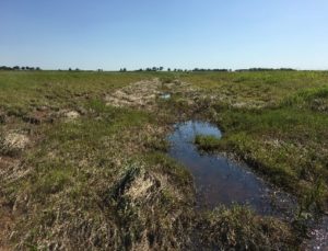
logo_updated_cc

Our Project Experience

Project Summaries

Producers Midstream Confidential Pipeline

Northwest Texas

ONEOK, Confidential Pipeline Projects

West and North Central Texas

Enbridge Line 61 Pipeline Project

Wisconsin and Northern Illinois

Laguna Atoscosa Reference Wetland Assessment

Harlingen, Texas

CORE Consulting, Confidential Wind Energy Facility Tier III Site Assessment for Federal and State Permitting

South Texas

Wind Repower Aquatic Features Survey, Natural Resource Assessment, and Permitting and Reporting

Iowa

Why You Need On Pointe For Your Project:

Regulations & Requirements

A comprehensive understanding of applicable regulations and requirements (Clean Water Act, Endangered Species Act, MBTA, Bald and Golden Eagle Protection Act, etc.).

Scientific Knowledge & Qualifications

Application of professional judgement along with scientific knowledge required to accurately delineate defensible wetland boundaries, identify protected cultural resources, and assess potential T&E habitat.

Project Management

Critical thinking skills and adaptive project management.

Data Collection

Accurate, On Pointe field data collection on the first site visit.

Records & Information Management

Detailed record keeping, survey progress tracking, data QA/QC, and dataset management.

Efficient Communication

Timely and thorough transfer of field data and continual communication of potential permitting or construction issues to project managers and other office-based project personnel to offset potential delays or problems.

Survey Team Management

The logistics and data management required for large survey efforts with multiple field teams.

Routing & Siting

Assistance with routing and siting to avoid sensitive environmental and cultural resources.

Survey Coordination

A strategic approach for coordinating survey access with ROW land agents and field teams to improve survey efficiency and reduce costs.

Safe & Legal Survey Access

Ability to work with land agents to safely, legally, and efficiently access survey areas.

Landowner Access Facilitation

Ability to facilitate issues associated with survey permissions and landowner interactions on private properties.

Professional, Reliable

Projects completed safely, on time, and on budget.

Project Summaries

Producers Midstream Confidential Pipeline

Location: Northwest Texas

USACE Districts: Fort Worth

On Pointe provided preliminary environmental and cultural due diligence, field surveys, reporting, permitting, and environmental inspection services for a pipeline gathering system totaling approximately 50 miles in northwest Texas. The project was kicked off with a desktop evaluation of potential project constraints for pipeline and facilities siting around known environmental and cultural resources. 


Upon preliminary route establishment, On Pointe biologists coordinated with right-of-way (ROW) land agents to set-up and schedule access to private properties and conducted field surveys for stream crossings, wetlands, and Threatened and Endangered Species habitat. The field team was responsible for processing field data, tracking survey progress and alignment changes, and informing the client of any additional routing recommendations and/or construction constraints.

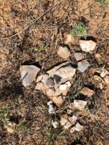
In addition, On Pointe managed the cultural resource surveys and coordinated with the cultural Principal Investigator. Cultural field surveys were conducted and permits required were obtained. Resource reports and geospatial data recorded with sub-meter accuracy were provided to the client. All field surveys were completed in a timely manner with no safety incidents. Field surveys, reporting, and permitting were completed under the proposed budget.

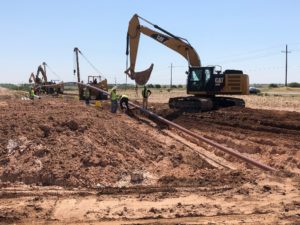
On Pointe returned to the project area to provide environmental inspection and compliance oversight services during the construction phase of the project. During this phase, the On Pointe team assisted the client with obtaining their railroad crossing and hydrostatic discharge permits.

Construction was completed in December of 2020.

ONEOK, Confidential Pipeline Projects

Location: West and North Central Texas

USACE Districts: Fort Worth and Albuquerque

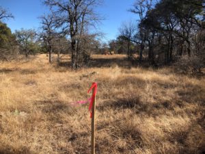
The On Pointe biological team was contracted to conduct and manage wetland delineation field surveys and Threatened & Endangered (T&E) habitat assessments on approximately 300-miles of proposed pipeline routes. The projects included seven separate lines located from west Texas (Permian Basin) to north-central Texas.

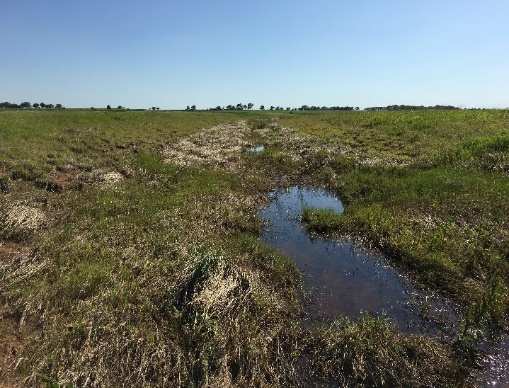
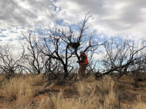
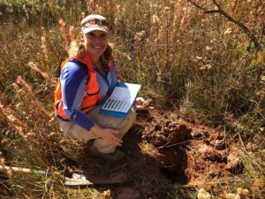
During their time in the field, On Pointe biologist were responsible for coordinating with multiple right-of-way (ROW) land agents to access private properties, conducting biological field surveys, tracking progress, processing GPS and other field data daily, coordinating with project management teams, and completing required safety protocols. The Great Plains and Arid West USACE Regional Supplements and other USACE guidance manuals were used to delineate wetlands and watercourses.

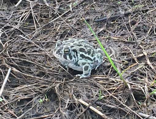
While conducting wetland delineations, they identified potential habitat for the federally endangered golden-cheeked warbler (GCWA) on several projects and conducted thorough habitat assessments, mapping potential nesting habitat and providing technical reports for informal coordination with USFWS in preparation for GCWA presence/absence surveys for Endangered Species Act (ESA) Section 7 compliance.  The team coordinated with the U.S. Fish and Wildlife (USFWS) Region 2 Migratory Bird Treaty Act (MBTA) office, to develop an MBTA pre-construction clearance survey protocol with recommended raptor disturbance buffers and performed clearance surveys.

The On Pointe biological team understands that team communication is the key to a successful project – from the landowners and land agents, to the field survey crews, to permitting and construction management teams. During these projects, they maintained close communication with management regarding potential natural resource construction issues, T&E species management recommendations, MBTA compliance recommendations, and potential re-route recommendations to avoid pre-construction notification (PCN) triggers in pursuit of Nationwide Permit (NWP) 12.

These projects successfully avoided all PCN triggers and have been constructed.

Enbridge Line 61 Pipeline Project

Location: Wisconsin and Northern Illinois

USACE Districts: St. Paul and Rock Island

While employed by a private consulting firm, On Pointe’s biologists managed multiple wetland delineation teams, which provided field services for delineating wetlands and waterbodies, completing wetland functional assessments (WRAM), conducting T&E species habitat assessments, and performing noxious weed surveys along approximately 300 miles of a 350-foot survey corridor (48-inch pipe).

Field project manager duties included scheduling landowner site visits in order to meet daily surveyed acreage quotas and managing and review of data for four delineation crews in the field. Delineations in agricultural areas, especially in rural northern Illinois, required knowledge of how to interpret problematic wetland situations (problematic vegetation, soils, and hydrology). Daily data submittal requirements included progress reports, USACE region-specific wetland delineation data sheets, and reviewed GPS data.

All teams followed strict safety compliance protocols and completed daily JSA paperwork and other safety reporting requirements. This project is currently under construction.

Laguna Atoscosa Reference Wetland Assessment

Location: Harlingen, Texas

USACE Districts: Galveston

On Pointe’s Professional Wetland Scientist designed and led wetland delineation and functional assessment surveys on the southern Texas Gulf Coast. The purpose of this project was the collection of baseline information on existing coastal wetlands pursuant to use as reference wetlands. Ecosystem Investment Partners (EIP) used these data for the creation of a permittee responsible wetland mitigation area for a confidential energy firm.

Transects and data points were placed and sampled in a manner as to thoroughly describe the habitat characteristics of each survey area and capture any unique qualities of wetland, transitional, and upland habitats. Elevations and USACE data sheets were recorded at each data point.

Services Provided:

  • Conducted wetland delineations using the USACE Atlantic and Gulf Coastal Plain Regional Supplement.
  • Set-up and surveyed transects according to USACE guidance (1987 Manual).
  • Performed surveys in the field along with EIP’s project manager.
  • Performed post survey data processing.
  • Provided comments for early-stage Permittee Responsible Mitigation wetland mitigation area design
  • Wrote reference area survey methodology section for the final Compensatory Mitigation Plan (CMP).

CORE Consulting, Confidential Wind Energy Facility Tier III Site Assessment for Federal and State Permitting

Location: South Texas

REGULATORY AGENCIES: USACE Galveston District, USFWS Region 2 Offices, Texas Parks and Wildlife Department

On Pointe’s biological team was contracted to conduct an environmental analysis of impacts to regulated resources within a WRA in Zapata, Texas for the development of a wind energy facility.

They conducted wetland delineations for stream crossings and other aquatic features and assessed potential habitat suitability for wildlife and threatened and endangered species for Tier III analysis and permitting. Results from the field survey were used for state and federal permit applications.

Wind Repower Aquatic Features Survey, Natural Resource Assessment, and Permitting and Reporting

Location: Iowa

REGULATORY AGENCIES: USACE Rock Island District, USFWS Region 3 Office, Iowa Department of Natural Resources (IDNR)

On Pointe was contracted to conduct wetland delineation services, threatened and endangered species habitat assessment, and permitting and reporting services on an 80 MW wind site that was being upgraded in North Central Iowa. The project area was dominated by prior converted cropland and as a result most of the aquatic features that were delineated were road-side ditches, agricultural ditches, and manipulated intermittent and ephemeral streams.

Because impacts to WOUS resulted in less than 0.10 acre of temporary impacts per crossing, the USACE agreed that the project qualified for Nationwide Permit 14 – Linear Transportation Projects. As part of the Iowa joint application process, project approvals were obtained from the IDNR Sovereign Lands Department and Floodplains Department. The project did not impact state or federally listed species. This project is currently in the construction repower phase.